Bringing early warning closer to communities of the Inkomati River Basin
The Multiple Hazards Early Warning System (MultiHEWS)
Risk AWARD 2023: Final Report
Since the launch of the project in late 2023 till summer 2026, the Munich Re Foundation has supported the South African NGO Association for Water and Rural Development (AWARD) in building a multi-hazard early warning system for the Inkomati River Basin. In a landscape where droughts can shape one season and the river can bring floods the next, how can communities stay one step ahead of water-related risks? Here is an overview.
.jpg/_jcr_content/renditions/original./2023%20RISK%20Award%20Final%20Report%20(2).jpg)
Background
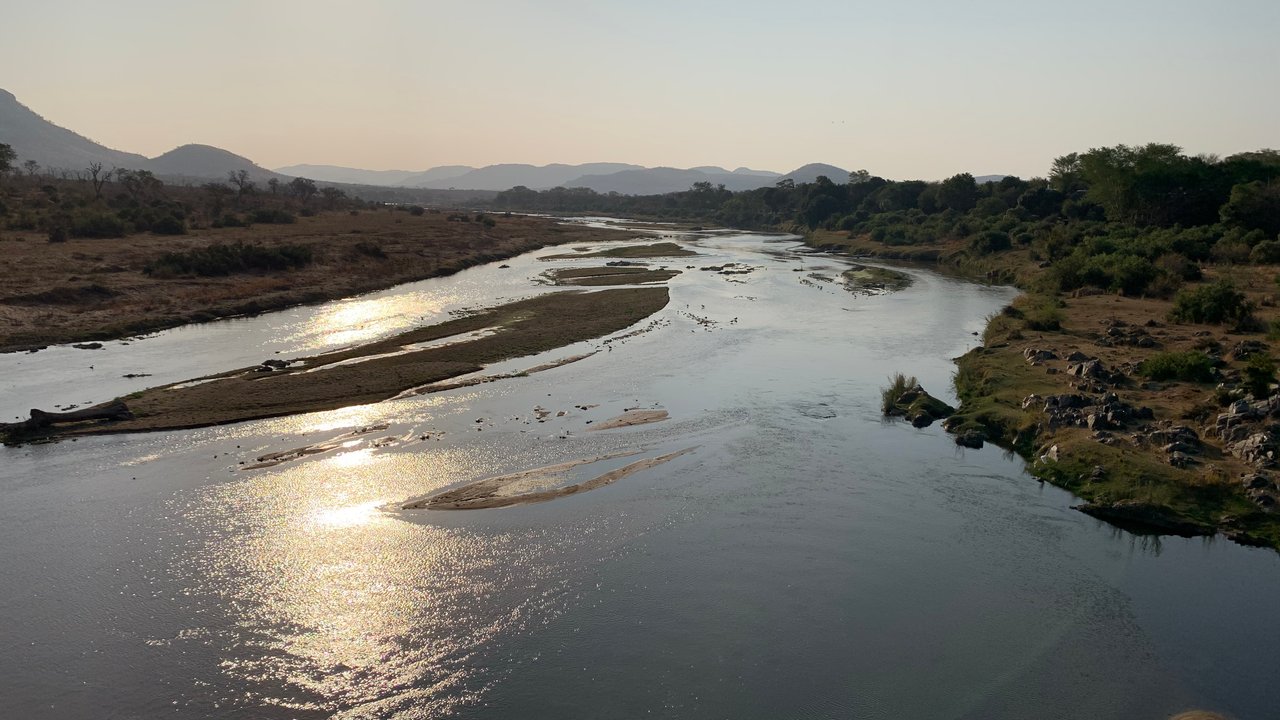
The Inkomati River Basin (IRB), shared by South Africa, Eswatini, and Mozambique, supports the livelihoods of around two million people. The basin's waters ensure an adequate supply of water for urban areas, irrigated and rain-fed agriculture, forestry, mining, tourism, and biodiversity conservation. And yet, these same activities are putting increasing pressure on water quantity and quality. Climate change intensifies the situation by altering rainfall, temperature, and hydrological variability, rendering the basin more susceptible to floods, droughts, and water scarcity.
In general, South Africa has disaster management structures to warn about an upcoming threat. The South African Weather Service (SAWS) disseminates weather-related early warnings to the National Disaster Management Center (NDMC), which then shares the information with provincial government departments and municipalities until it reaches communities and the wider public. Yet the practical gap lies in ensuring that warning information moves quickly enough through the right channels with sufficient role of clarity and agreed procedures to support timely preparedness and response. The Multiple Hazards Early Warning System (MultiHEWS) project addresses these challenges in three main steps.
Step 1: Two outstanding technological tools
One of the project's central focuses was the development and improvement of digital tools to help transform water data into actionable information.
One of these tools is FlowTracker, a mobile application used to monitor rivers and dams. With support from the Munich Re Foundation, AWARD extended FlowTracker's reach to the Inkomati River Basin and integrated data from the Global Flood Awareness System (GloFAS), an international flood forecasting service. As a result, users can now see not only current river conditions as before but also forecast potential flood risks for the upcoming days. The app also allows authorised users to take photos of river gauges and submit water-level observations directly from the field. These observations help verify and complement automated monitoring data, making the overall early warning system more accurate.
.jpg/_jcr_content/renditions/original./2023%20RISK%20Award%20Final%20Report%20(1).jpg "Regional Water Security Assessment Dashboard")
The dashboard of the new Multi HEWS.
The project's second major technical achievement was the creation of the MultiHEWS prototype dashboard. While the FlowTracker helps collect and verify information directly from the field, the dashboard MultiHEWS serves as a central platform for bringing together risk-relevant information on multiple issues such as river flow data, flood forecasts, water quality information and community risk profiles. It helps support early warning and disaster preparedness for communities in the Inkomati River Basin.
Step 2: Connecting institutions and communities
Generating warning data is only half of the battle. Another key challenge identified by the project was the gap between the interpretation of technical risk information and institutional decision-making. These two elements do not always align seamlessly.
To better understand these gaps, the project worked closely with public sector institutions responsible for water resource management, disaster risk reduction, municipal planning, public communication, and action. Through workshops, stakeholder forums and technical meetings, AWARD explored the operational realities of early warning in detail. This included examining how warnings are currently received and disseminated, which communication channels are used during disaster events and what preparedness or response protocols exist. The project also considered what support would be required for MultiHEWS to become practically useful.
.jpg/_jcr_content/renditions/crop-16x9-1280.jpg./crop-16x9-1280.jpg "Meeting with City of Mbombela, Environmental Management Unit, including Senior Manager Khethiwe Malaza")
Jai Clifford-Holmes, director of AWARD, meets with representatives of City of Mbombela.
These engagements demonstrated the importance of clear roles, real-time information flows, and communication pathways between technical staff, disaster management officials, political leaders, and local communities. The project therefore sought to align MultiHEWS initiatives with existing disaster management and water governance structures, paving the way for a warning system that can support informed decision-making and prompt action.

Jai is demonstrating the MultiHEWS dashboard to Lyncia Mkhabela (CoM – Senior Manager Disaster Risk Reduction)
Step 3: Bringing early warning closer to communities
The success or failure of early warning systems hinges on whether risk information reaches the people who need to act on it. For MultiHEWS, this meant looking beyond institutional mandates and technical tools to gain a better understanding of the household and community conditions that influence vulnerability, preparedness, and response.
To this end, AWARD conducted surveys in 53 households across four vulnerable communities in the Inkomati River Basin. These revealed valuable insights into household water access, river use, communication channels, and exposure to flood, drought, and water quality risks. One of the project's most crucial findings is related to communication. Although many respondents had access to smartphones and digital platforms, nearly 60% said that they preferred to receive important information at community meetings. The results showed that digital technologies alone cannot guarantee that warnings reach everyone in time.
These findings helped build a more detailed picture of local vulnerabilities and strengthen the community's risk profiles. They also showed that effective early warning communication should combine digital tools and disaster-management institutions with existing community networks, such as councillors, community development workers, local radio stations, schools, and other trusted local organisations. In other words, a warning is only effective if it is understood, trusted, and acted upon.
.jpg/_jcr_content/renditions/crop-16x9-1280.jpg./crop-16x9-1280.jpg "A staff member of the AWARD is conducting an interview with a local resident.")
A staff member of AWARD is conducting an interview with a local resident
Sustainability and next steps
So how can communities stay one step ahead of water-related risks? The MultiHEWS project suggests that the answer lies not in technology alone, but in connecting reliable data, effective institutions and trusted communication into a system that enables timely action before a hazard becomes a disaster.
The RISK Award funding provided AWARD with the opportunity to move MultiHEWS from an early concept into a practical, institutionally connected prototype for a multi-hazard early warning in the Inkomati system. The project has fostered a deeper understanding of the basin’s interconnected flood, drought, low-flow, water quality and public health risks, and has developed community-level evidence from four river-linked sites. It has also strengthened the technical basis of the MultiHEWS dashboard and FlowTracker, and established partnerships with key stakeholders across the basin.
However, the MultiHEWS project should be understood as a socio-technical foundation rather than a fully finished operational early warning system. The next step is to progress from prototype to implementation. This will involve finalising data pipelines, testing the prototype with end users, developing trigger protocols, and piloting last-mile communication arrangements to turn warning information into timely action on the ground.
10 September 2026
Further information